You are here
Tsunamis! Coast Challenge
How can we predict tsunamis and protect coastal residents from their impact?
 That is what middle school kids learned about in a Tsunami camp held August 11-15th at CMOP. Through hands-on activities, students explored the science of tsunamis and earthquakes: geological structures, plate tectonics, and the physics of waves and water. They mapped recent volcanic eruptions, earthquakes and tsunamis, and note their relationship to boundaries in the Earth’s lithosphere. They students are also studied sediment records and learned how to measure sea-floor spreading.
A large group of students came from the Native American Youth Association. These students attend schools around the Portland metro area including Sunnyside Environmental School, Sellwood Middle School, and Parkrose Middle School. The camp was taught by Karen Wegner and Misty Scevola.
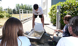
 In the earthquake and tsunami preparation segment of the camp, teams used computer models and maps to help define impact zones and use current inundation mapping to explain why some areas are dangerous, and where they might find safe-zones, safe-structures, and evacuation routes.
[View video of safe-structures in wave tank]
By weeks end, students took the knowledge they gained about Tsunamis to produce public service announcements (PSA). They were broken up into teams to write scripts, build sets, and videotape their PSA's. The camp ended with the teams presenting their PSA's to the rest of the class.
Watch the PSA's below by clicking on the images.
 The Beaverton/Valley Times newspaper covered the story about the camp. Read the article.


