You are here
14 July 2008 R/V Wecoma cruise - Cape Falcon line
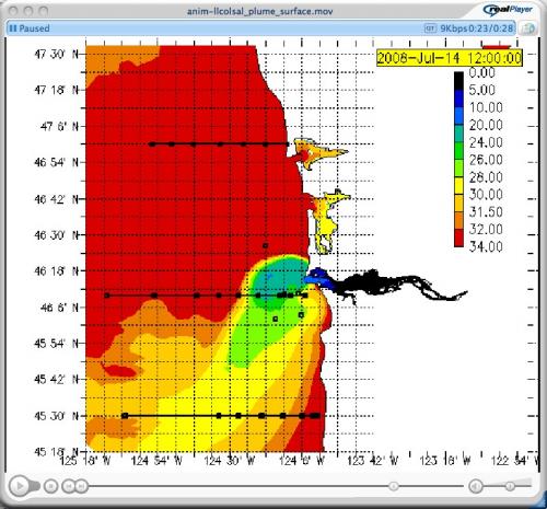
 Today we sampled along the Cape Falcon line, which is just south of the Columbia River Line and is, according to the CORIE forecast, awash with the Columbia River Plume. The CORIE modeling team emailed me an animation of surface salinity in this region, and we conducted CTD casts along the line until we found low salinity water. Coastal seawater in this area has a salinity of about 33, but plume water is less than 30. The station with the lowest salinity at the surface (28) was our farthest offshore station which lies more than 35 nautical miles from the river mouth. The forecast animation was correct on the salinity values, but the center of the plume crossed the Cape Falcon line farther off shore than predicted.
We began this series the evening of the 13th, casting the CTD at seven stations going west to east (CF-b, a, 40, 30, 20, 10, 7, 3), and once the sun came up we repeated the stations going east to west. We collected water at two stations to characterize the aging plume water (CF-30 with surface salinity of 30, and CF-a with surface salinity of 28).
After we finished this series we cruised directly to CF-10 to continue our CTD survey over the 100m isobath going north along the Washington coast.

Screen Grab of Forecast animation of surface salinity. :
Cape Falcon line (not marked) runs east to west at 44 deg, 44' latitude


